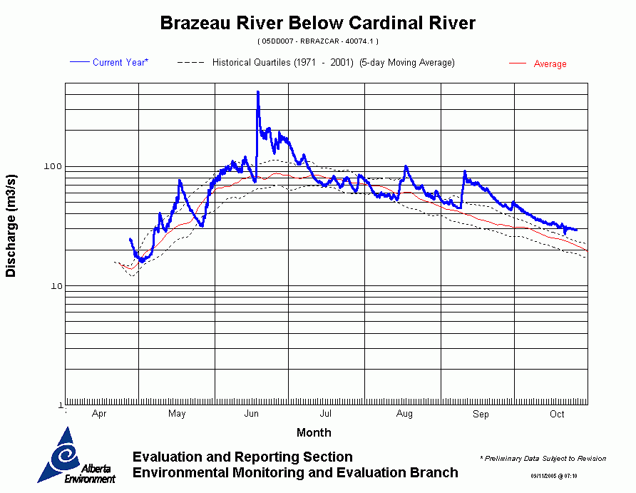
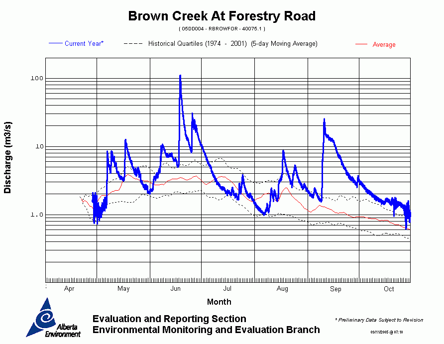
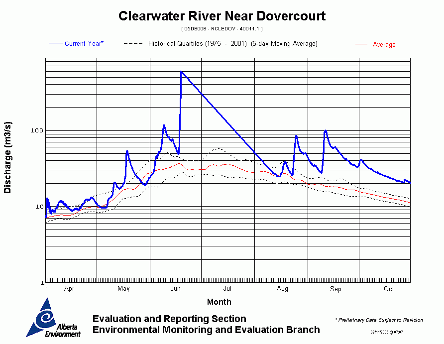
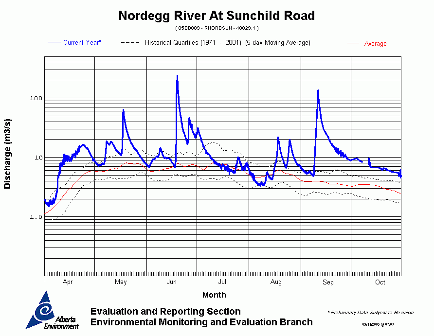
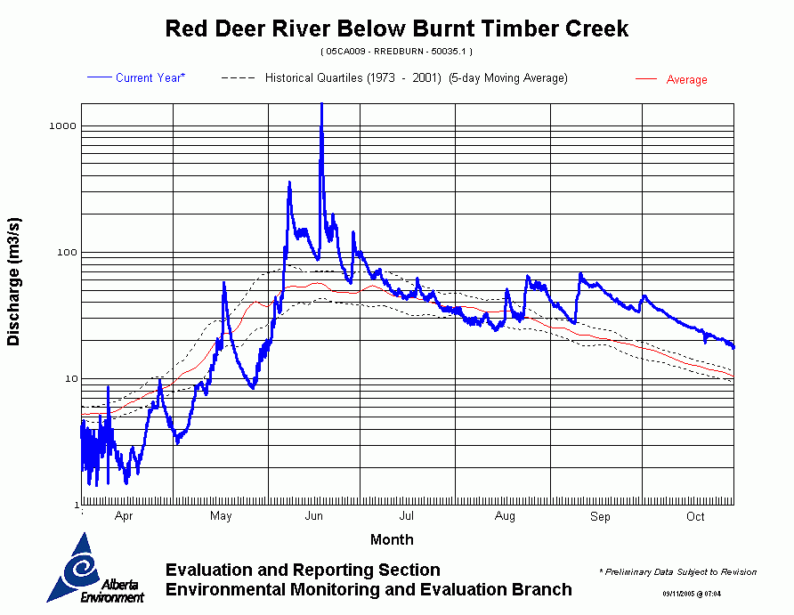
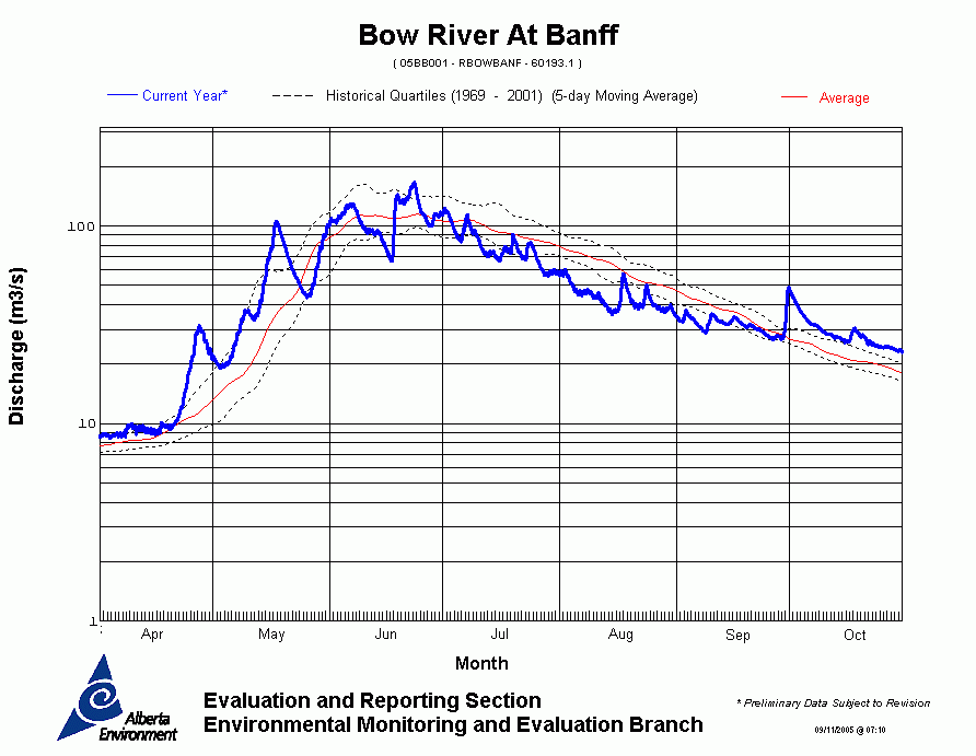
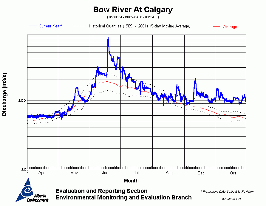
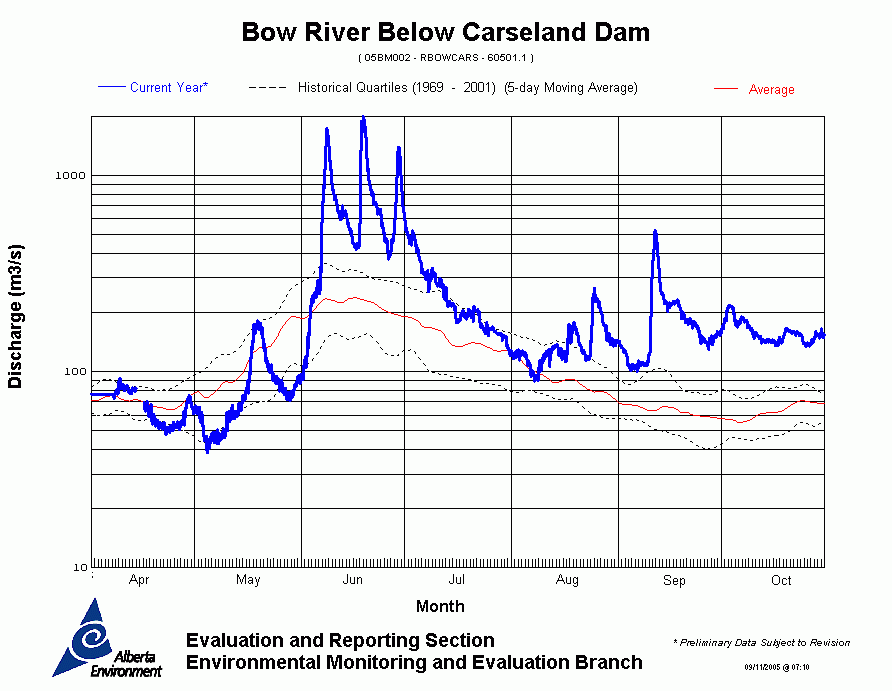
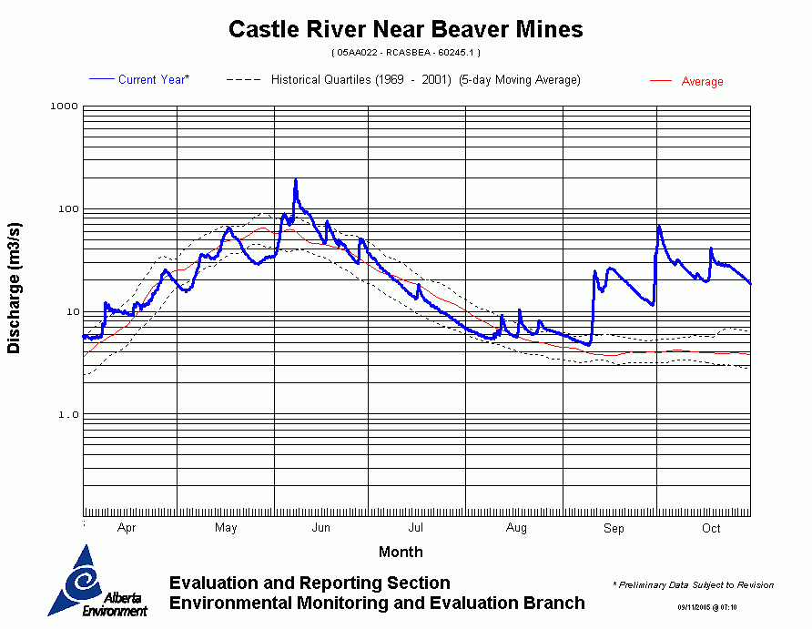
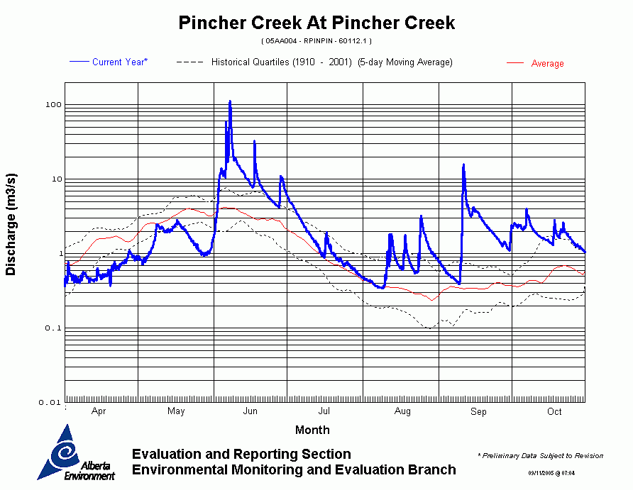
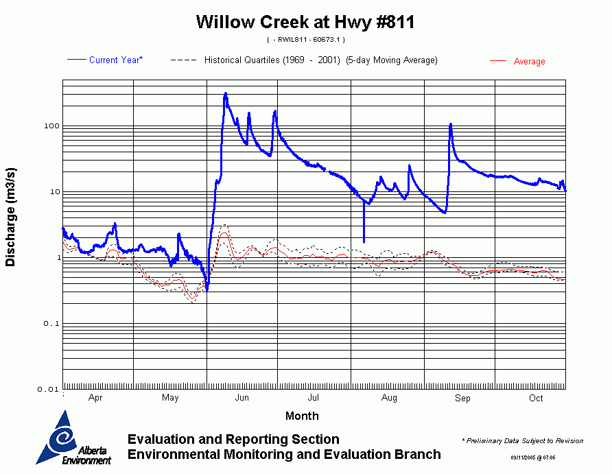
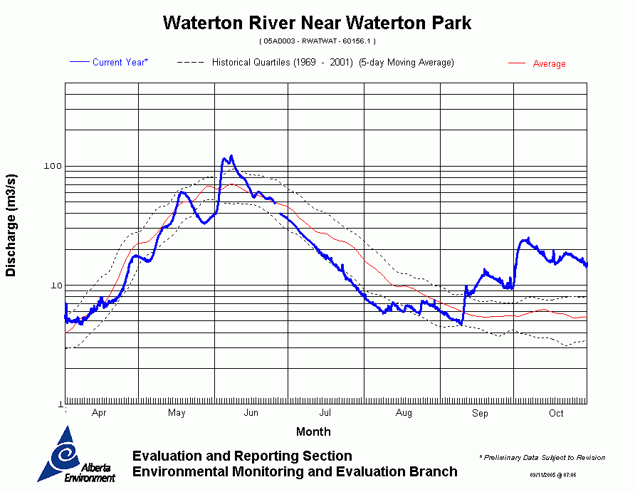
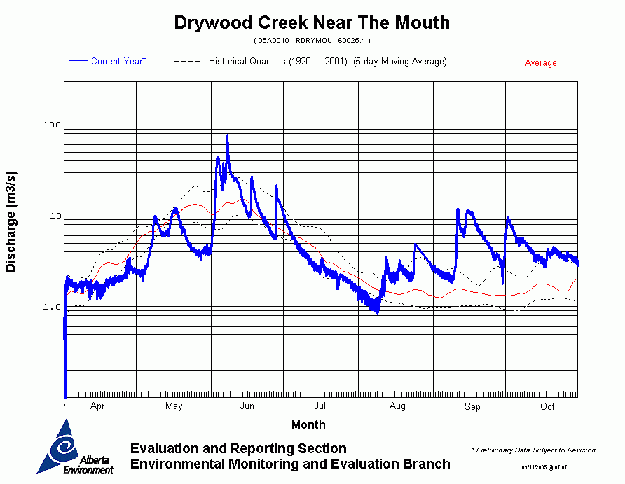
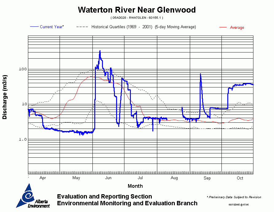
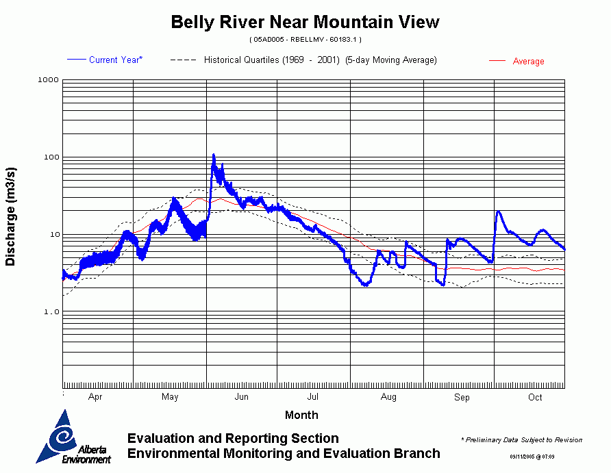
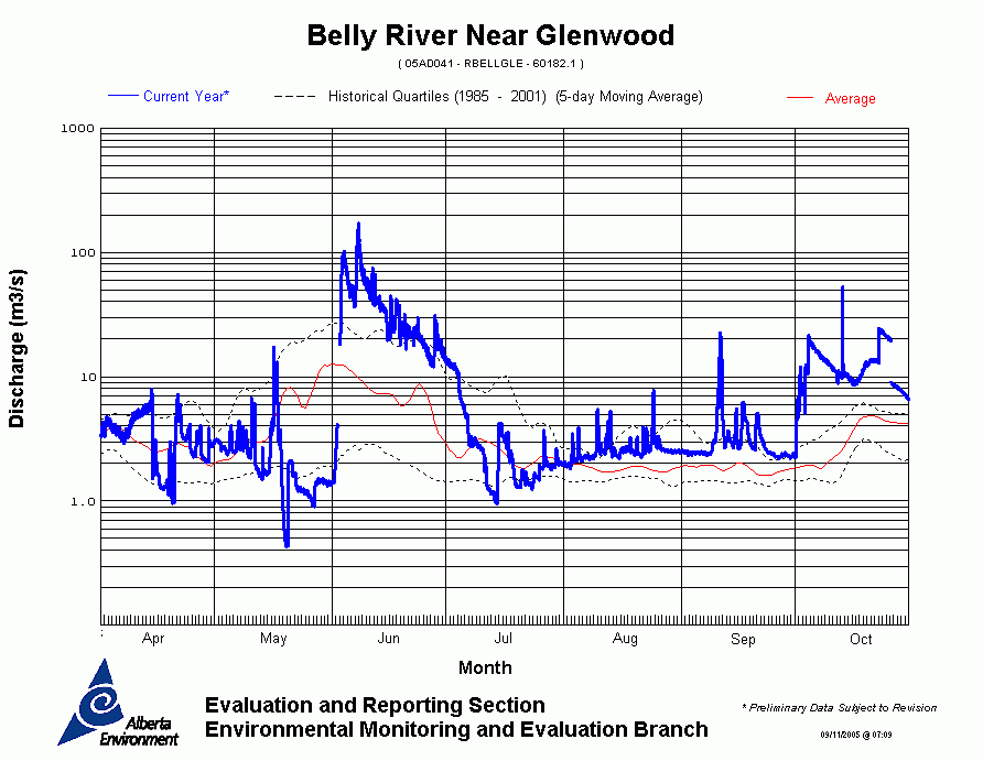
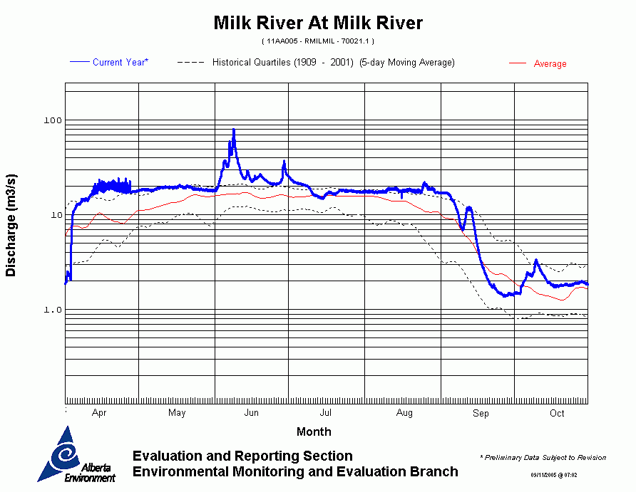
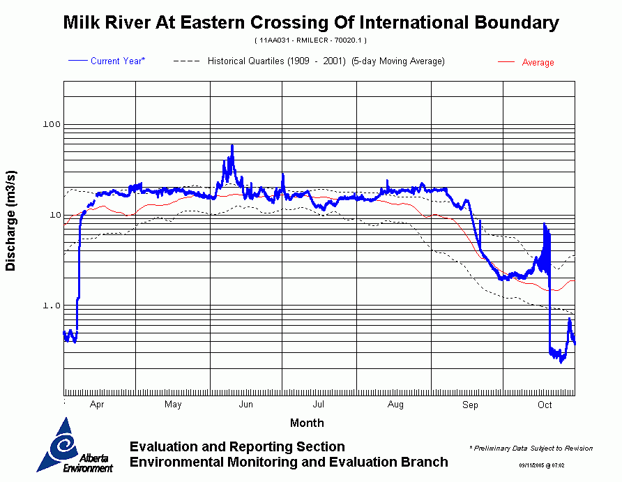
Alberta Environment flood estimates
|
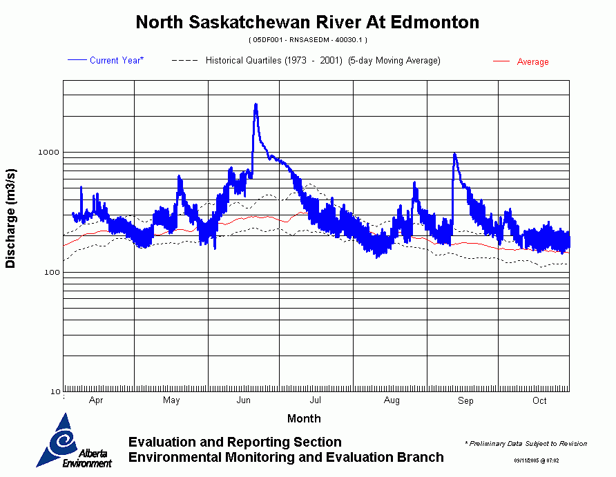
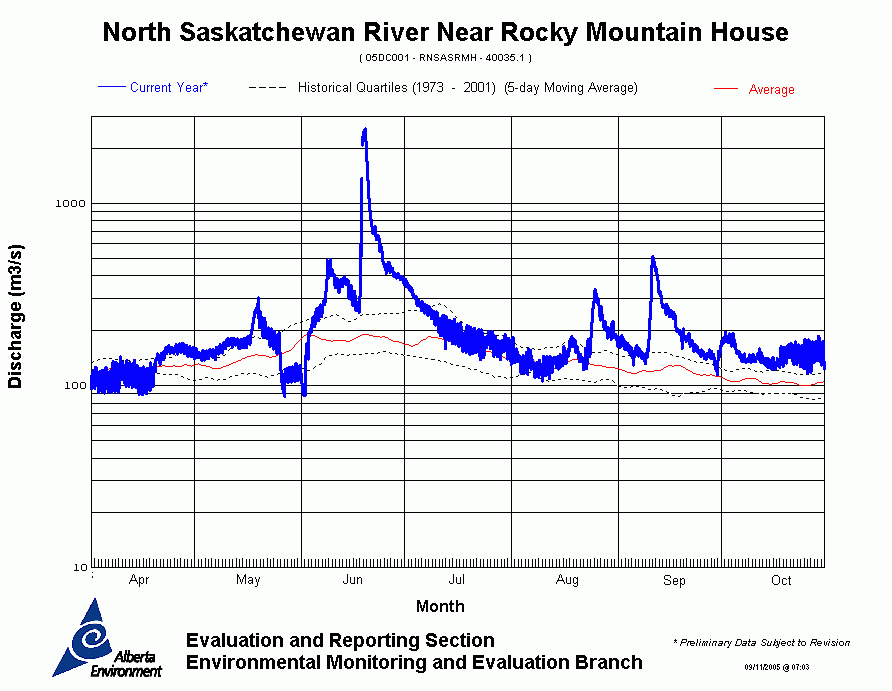
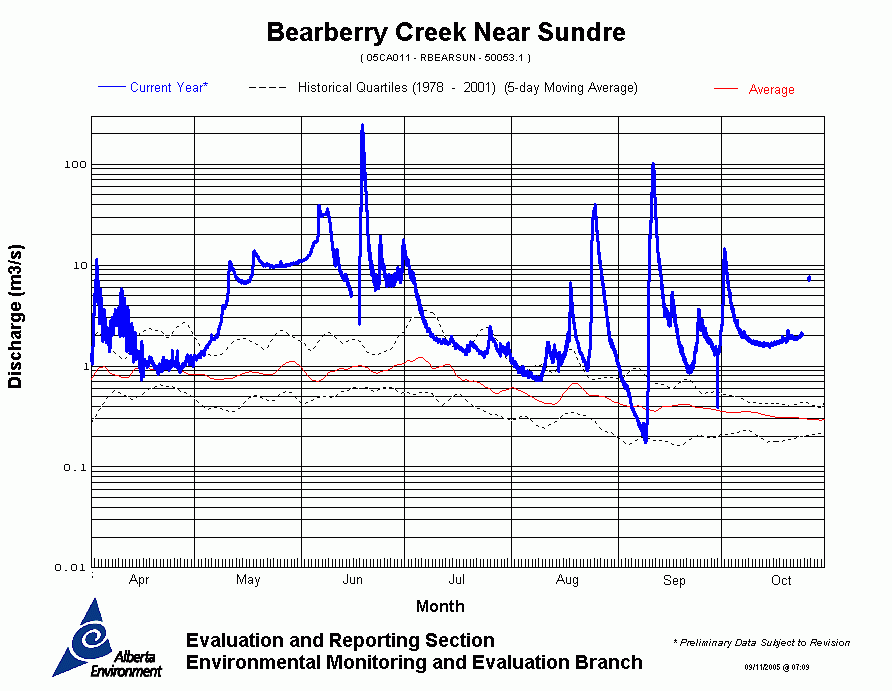
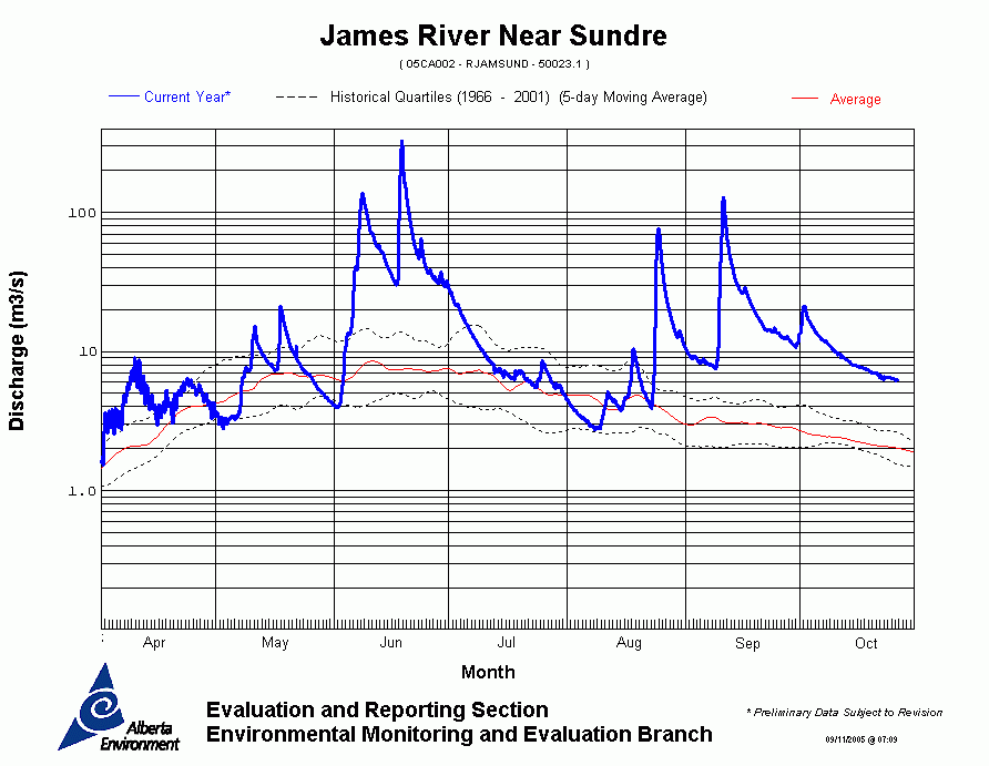
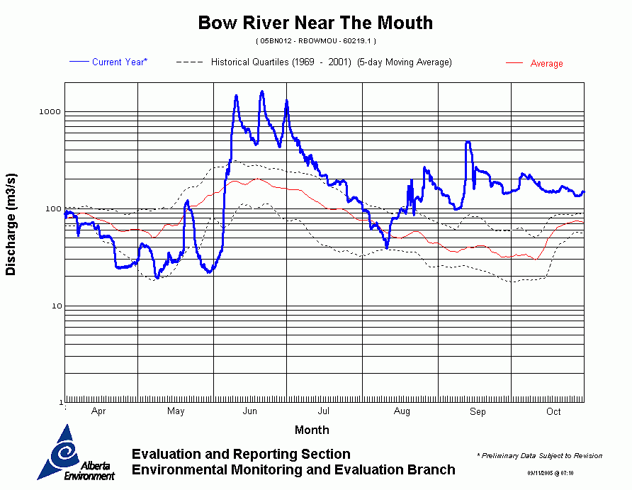
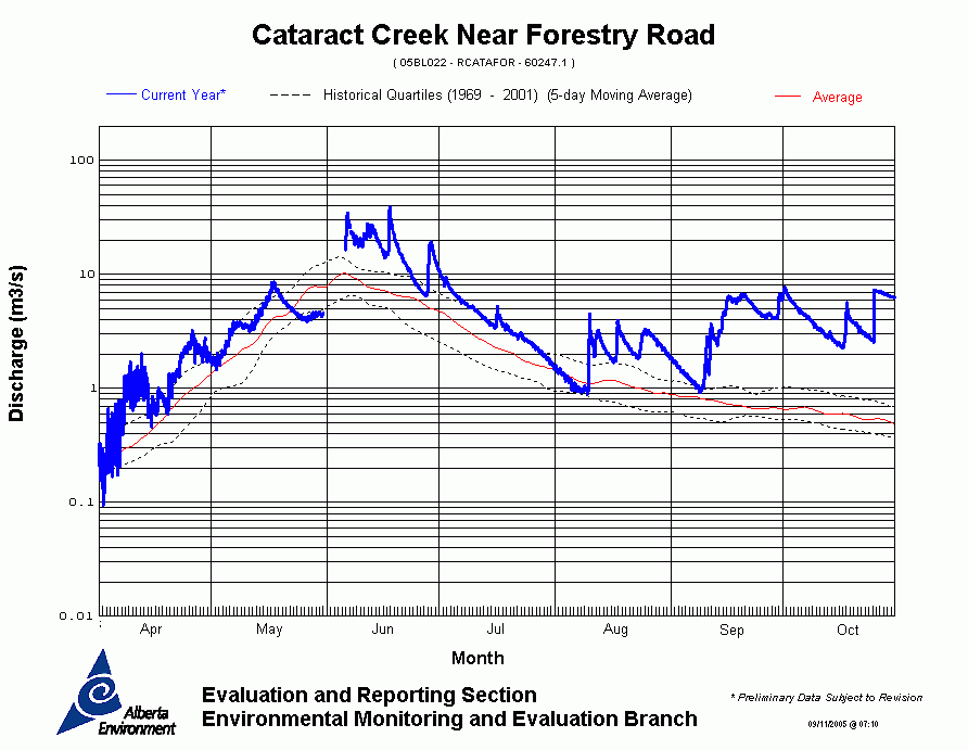
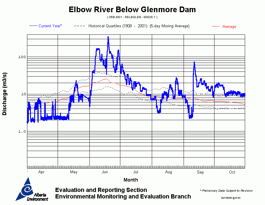
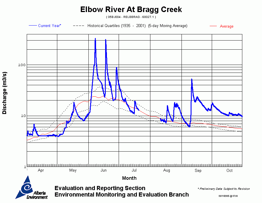
Alberta Environment collected information during the June 2005 flooding to
estimate the peak water flows in rivers across the province. These water flows
have been used to predict the likelihood that a flood of similar scale could
occur in any given year.
These are preliminary results that will be confirmed as Environment Canada finalizes their information over the next year.
North Saskatchewan River Basin
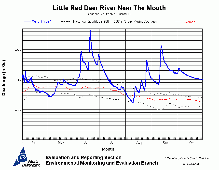
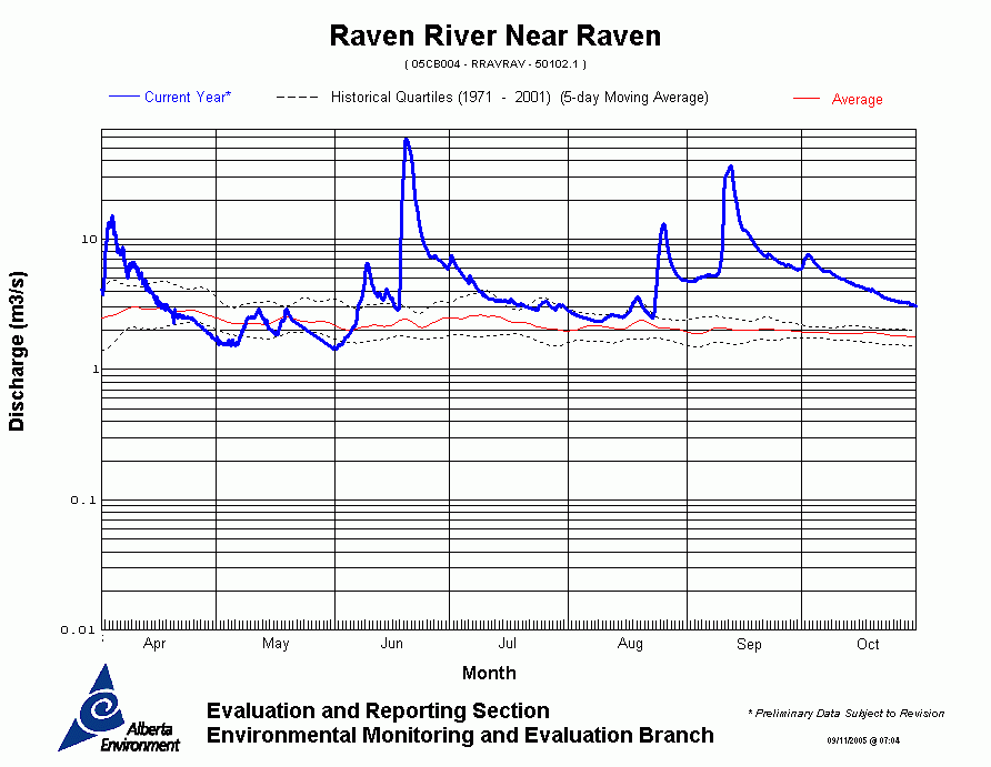
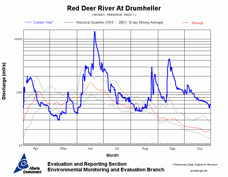
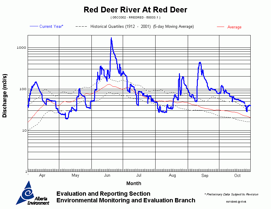
Red Deer River Basin
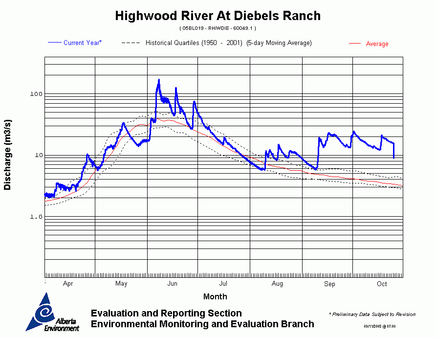
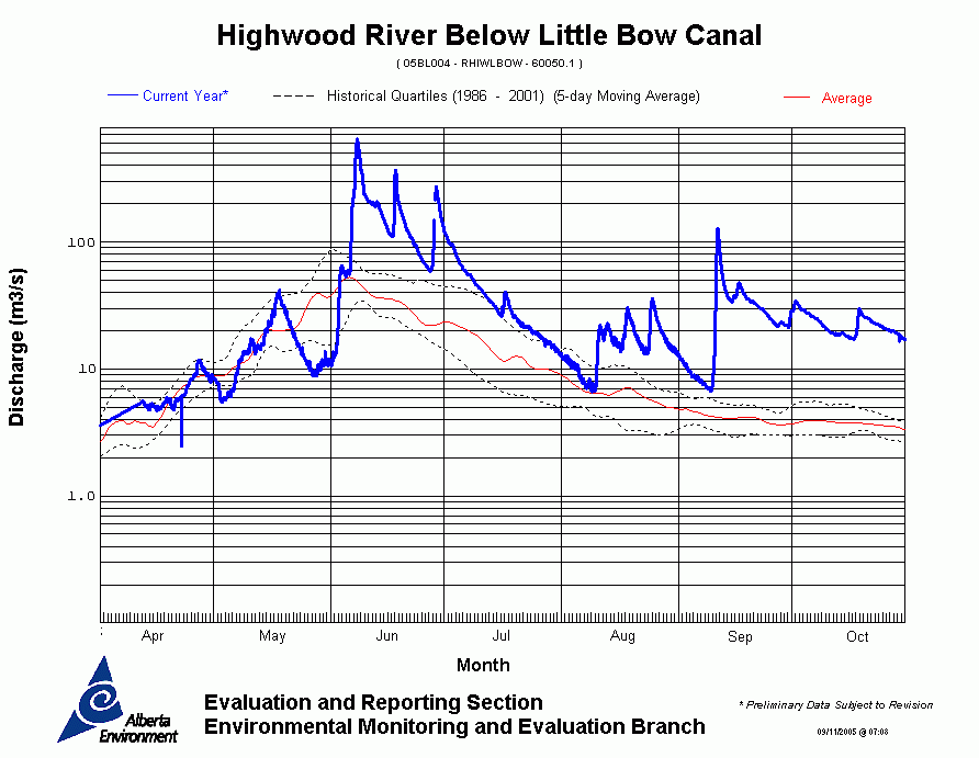
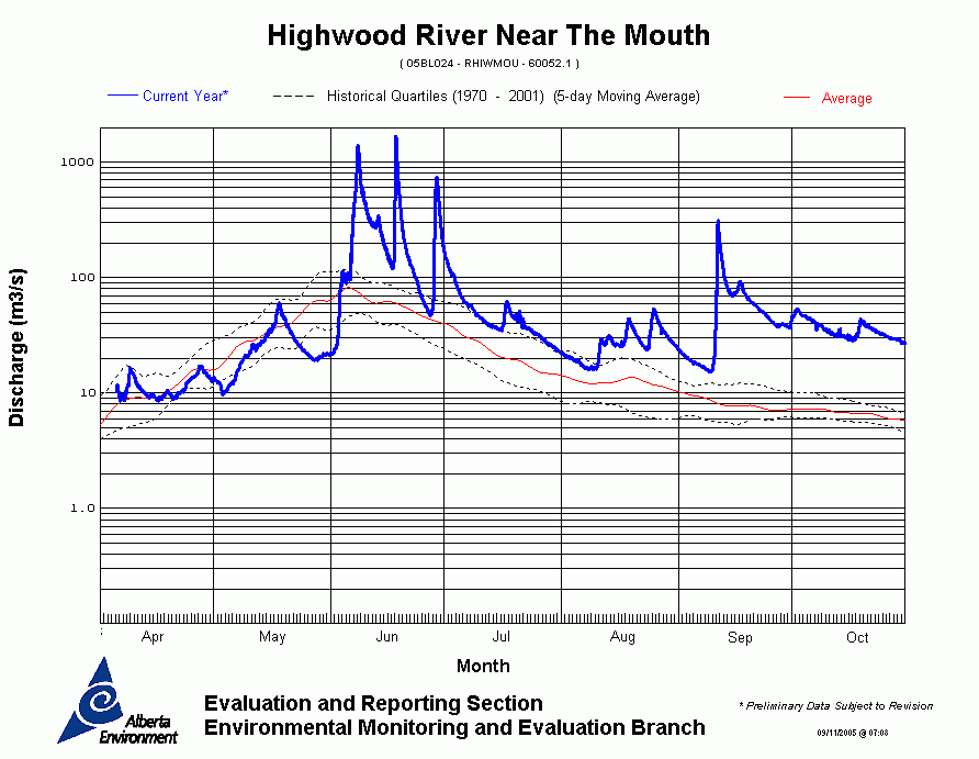
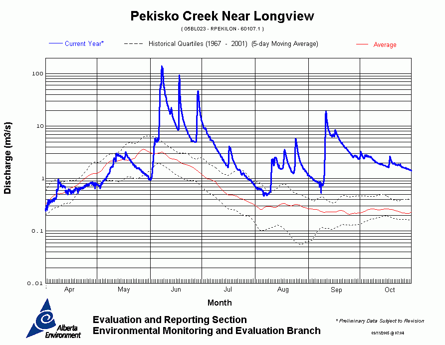
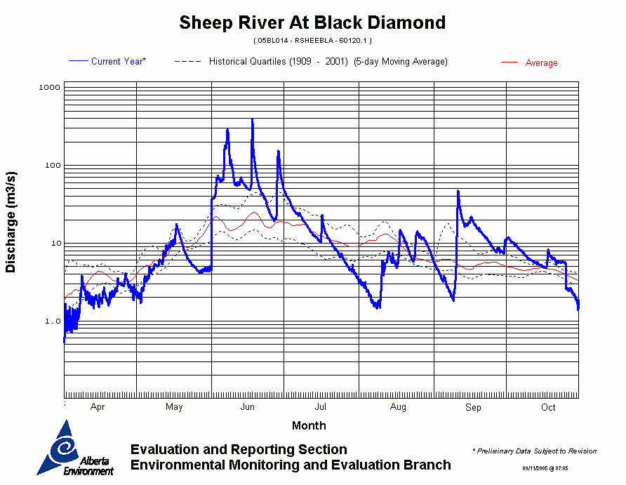
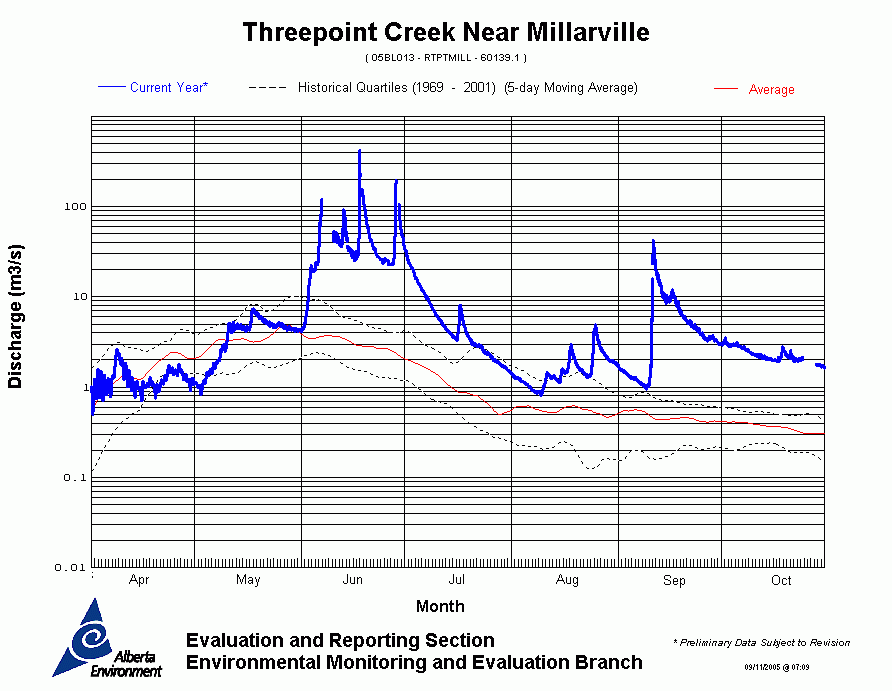
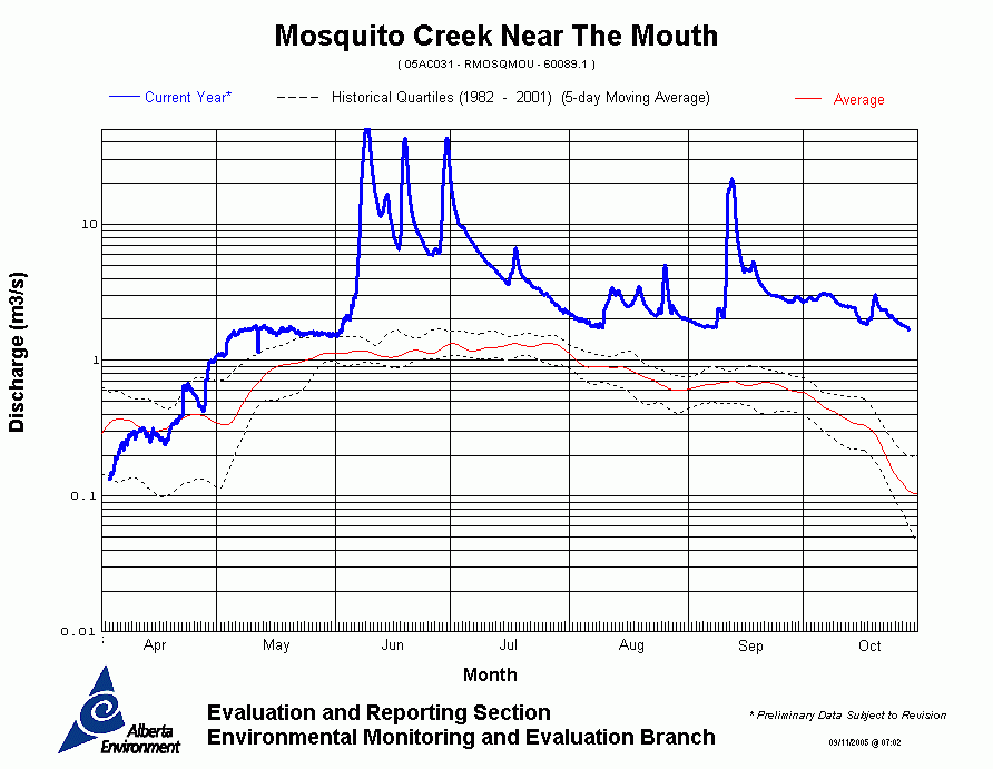
Bow River Basin
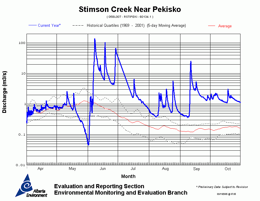
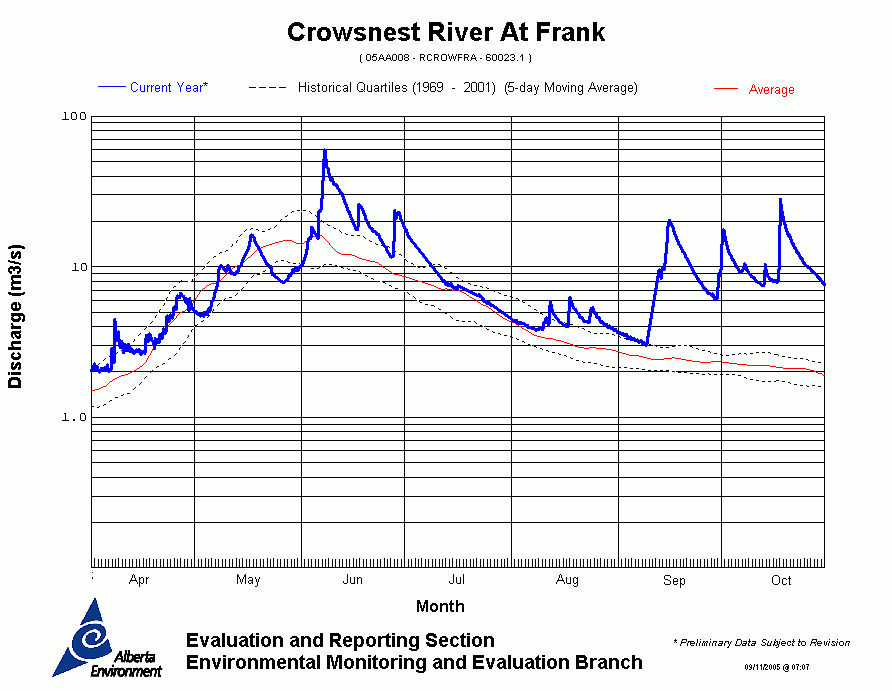
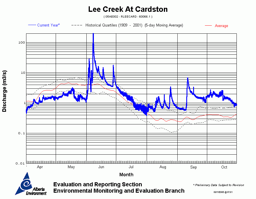
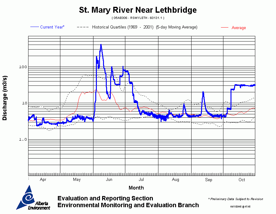
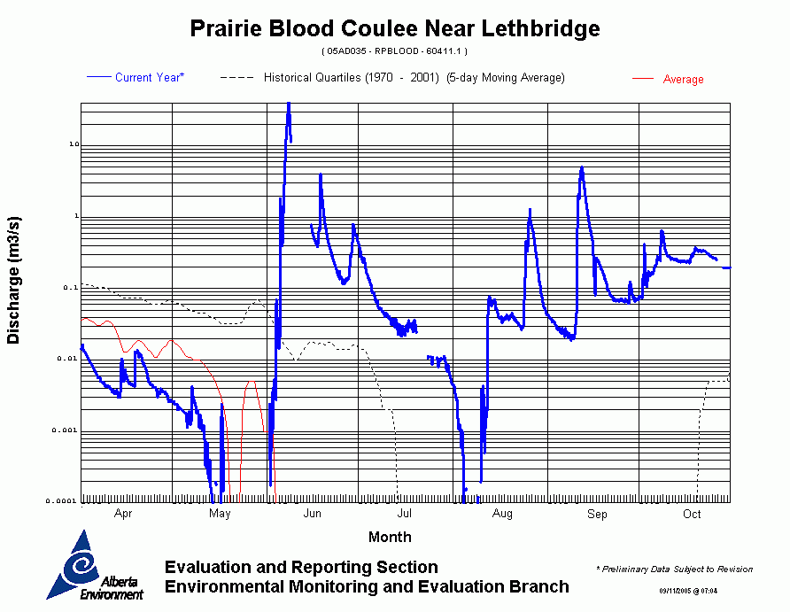
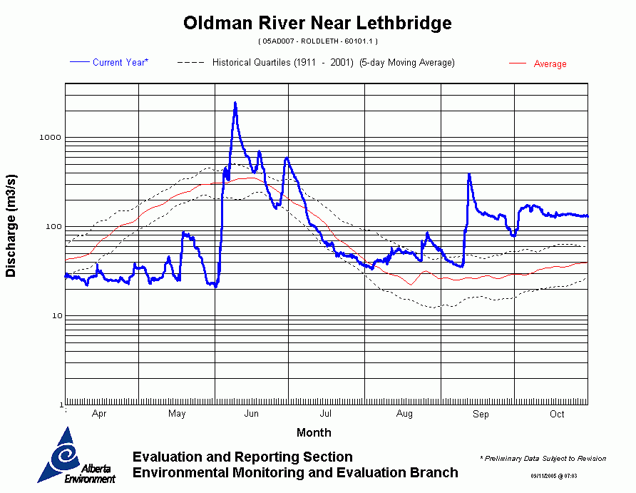
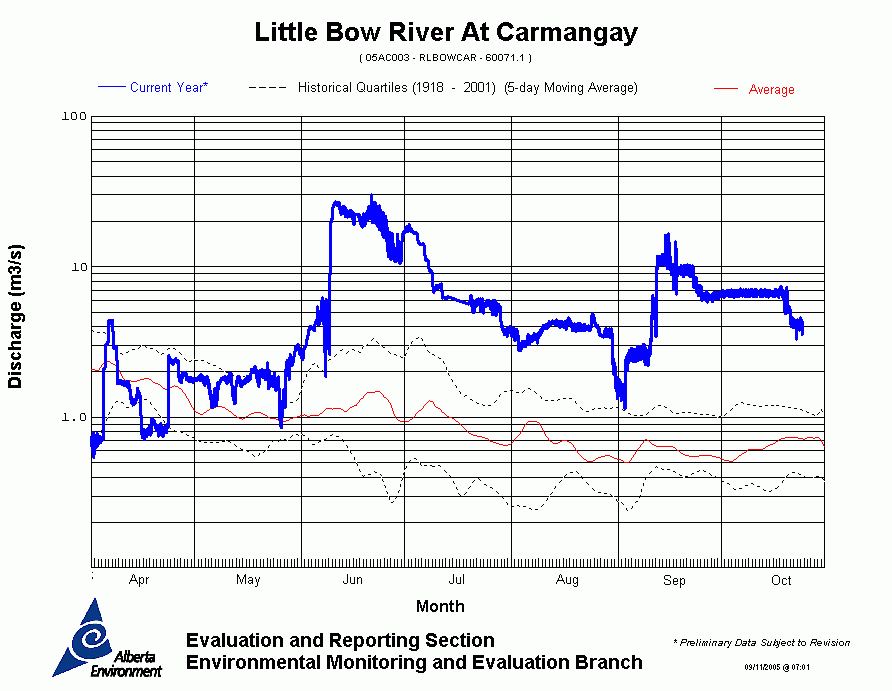
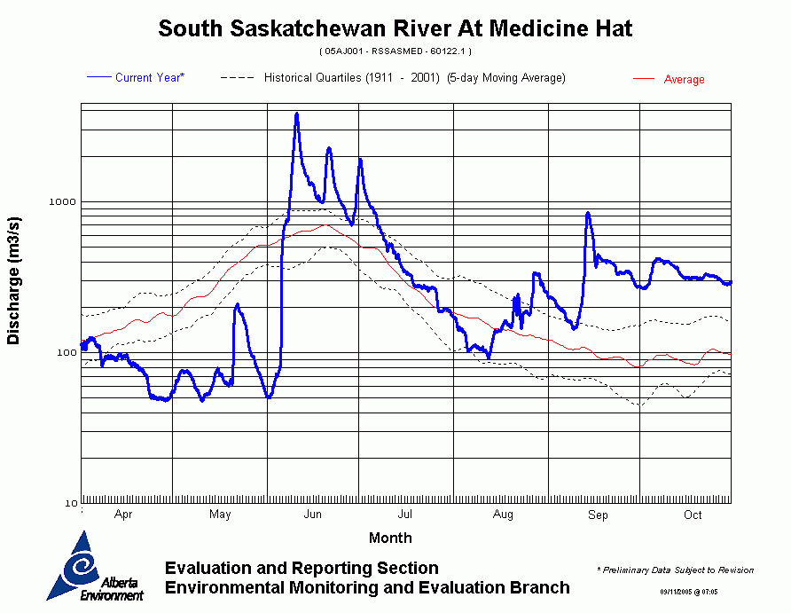
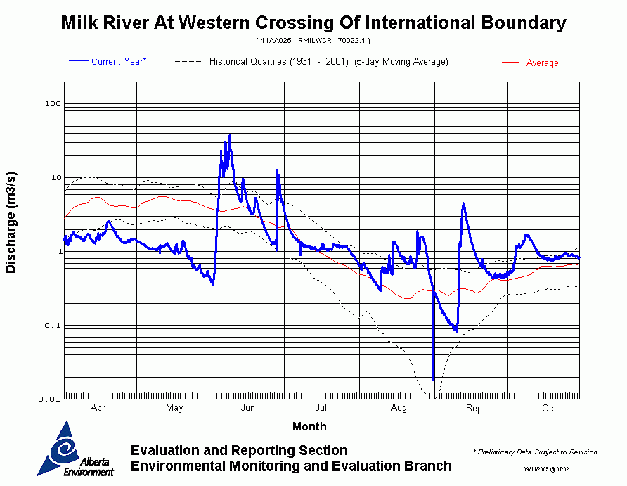
Oldman River Basin
|
For technical enquires about
this web page please contact
Alberta Environment - Environmental Management
Water Management Operations Branch at
AENV-WebWS@gov.ab.ca